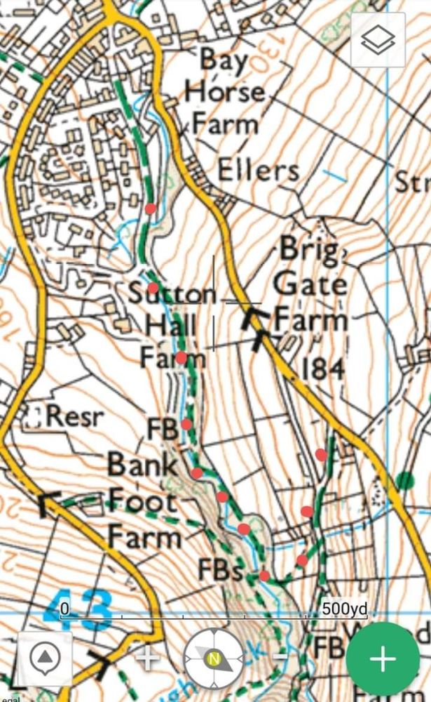
Bridleways - Lumb Clough
Posted on
On Ordnance Survey maps:
A green dotted line indicates a public footpath.
A green dashed line indicates a public bridleway.
A line of green crosses indicates a byway open to all traffic.
A line of green T shaped dashes indicates a restricted byway
Green dots indicate other routes with public access.
Public bridleways can be used by walkers, horse riders and cyclists.
Horse riders and cyclists must keep to the bridleway route.
Cyclist must giveway to pedestrians and horses.
Ordance Survey Map below:
The bridleway proceeds along Sutton Hall Drive in a southerly direction, follows the main footpath and then takes a sharp turn below Wood Vale Farm. Please note there is not a through way the route goes over styles and through a kissing gate.
This is the only section of bridleway in the Clough. All other paths are footpaths only.
